University of Washington meteorology professor Cliff Mass talks about gusts on his blog and starts to explain why the westerlies are so exciting as you get closer to the town side of the Bay.
Last night I was sitting at my desk enjoying the sound of the winds..and it was quite an audio treat. I would hear the rumble in the distance. It would get closer and closer. Then the house and trees would shake.
As all of you know, the wind is almost never constant, with ebbs and flows. As a result, meteorologists often talk about sustained winds and wind gusts.
Sustained winds are the winds averaged over a period of time, typically two minutes. Gusts are the maximum winds (or actually maximum three-second winds for NWS sensors) during some period (often the same as the sustained winds).
Wind gusts can be a LOT stronger than the sustained winds…a typical value is 30-40% stronger, but on occasions it can be more. Here is an example at the UW for the last 24-h–look at the top row which shows both sustained winds and gusts.
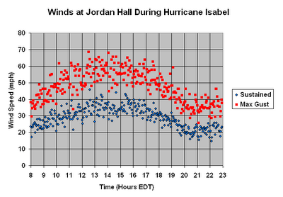
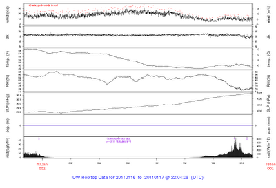 Not unusual for the gusts to be 10 knots greater than the sustained winds. Or here are the winds in a hurricane–gusts were nearly twice the sustained winds at times.
 A lot of time you can hear the roar of gusts before the strong winds hit, as I noted above. The anticipation is half the fun.
So why are there gusts in the first place?
The key reason is that gusts represent the mixing down of stronger winds from aloft. As many of you know, winds generally increase with height. The surface is relatively rough, with all the houses, trees, hills, etc. that slows the winds down at low levels. Aloft, away from the surface friction and drag. winds are stronger. The atmosphere is also a turbulence place…particularly when winds are strong or the surface is heated by the sun. The turbulence motions (called turbulent eddies in the business) mix the air in the vertical. You have all seen these eddies during the fall when leaves are flying up and down near the surface during windy periods.
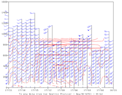
Where an eddy brings air down from aloft the winds increase–you have a gust. When the air is moving back up, the winds slow. Last night we had some very strong winds aloft (see the Seattle profiler winds below)…at some points 50 knot sustained winds were only a few hundred meters above the surface. When some of that fast moving air moved down to the surface in an eddy, you had one hell of a gust.
Current numerical weather prediction models only provide sustained winds…they don’t do gusts, which are too small a scale to directly simulate. So meteorologists have to add them to the predicted winds.
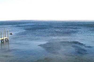
By the way, you can also see gusts on the water as darkened patches…known as “cats paws” by marine types (see pic).
